 www.geodatenkatalog.de (S1L)
Keyword
mineral deposit
7 record(s)
Provided by
Type of resources
Available actions
Topics
Keywords
Contact for the resource
Update frequencies
Service types
-

Since the end of the 1980ies the geological, areal and production data of operating mining sites have been collected systematically by LGRB. The periodic update of this information is carried out every four or five years. Main reasons are 1) the preparation of the periodic follow-up of the 12 regional development plans, 2) the work on the near-surface mineral raw material maps published by LGRB, and 3) the periodical editing of the state report for near-surface mineral raw materials published by LGRB at the start of each new election period. The geological data include a detailed documentation of the thickness, petrography and quality of mined rock(s) and the overburden as well as geochemical data gained from rock samples. The areal data refer both to the permitted mining area (zones of recultivation, work and expansion) and to possible areas for the mine expansion (the latter are confidential). Due to the quick spatiotemporal variability of these data, here all mining sites are shown as point data. The confidential annual production data are the basis for the periodic raw material report. In addition, another data are collected, e.g. for the mining permission, the delivery area and the subsequent land use. All these data are stored in the mining site database of the LGRB (Rohstoffgewinnungs-stellendatenbank = RGDB). This one comprises also the data for abandoned mining sites and mines. In total, actual (2021) about 14.000 data records are stored. The name of each mining site (e.g. RG 6826-3) consists of three parts. RG is the abbreviation for "Rohstoffgewinnungsstelle". the following four-digit number means the number of the relevant topographic map 1 : 25.000. The last number means the serial number of the mining site; serial numbers 1-99 mark operating mining sites gathered since the end of the 1980ies ( (today partially already closed) , such > 100 mark abandoned mining sites collected before 1980 and such > 300 mark data of mining sites and mines collected in the course of actual raw material mapping. The mintell4eu data set comprises all mining sites with serial numbers 1-99. In addition, the most important abandoned mines of former or probably still ongoing economic importance.
-
Since 1999, the Geologic Survey of Baden-Württemberg publishes a statewide geological map series 1 : 50 000 "Karte der mineralischen Rohstoffe 1 : 50 000 (KMR 50)". On it, the distribution of near-surface mineral raw material prospects and occurrences (mainly) and deposits (subordinate) is shown. This continuously completed and updated map currently covers around 60% of the federal state. It is the base for the regional associations in the task of mineral planning. The prospects and occurrences are classified according to different raw material groups (e.g. raw material for crushed stone (limestone, igneous rocks, metamorphic rocks, sand and gravel), raw materials for cement, dimension stone, high purity limestone, gypsum ...). Their spatial delineation is based on various group-specific criteria such as minimum workable thickness, minimum resources, ratio overburden/workable thickness, and so on. It is assumed that they contain deposits as a whole or in parts. In the vast majority of cases, the data is not sufficient for the immediate planning of mining projects, but it does facilitate the selection of exploration areas. The name of each area (e.g. L 6926-3) consists of three parts. L = roman rnumeral fo 50, 6926 = sheet number of the topographic map 1 : 50 000, 3 = number of the area/mineral occurrence shown on this sheet. Co-occurring land-use conflicts, e.g. water protection areas and nature conservation areas, forestry and agriculture, are not taken into account in the processing of KMR 50. Their assessment is the task of land use planning, the licensing authorities and the companies interested in mining. The data is stored in the statewide raw material area database "olan-db" of the LGRB.
-

This Downloadservice contains point locations of near-surface mineral raw material occurrences and mining sites in Baden-Württemberg (BW), which is one of 16 states of the Federal Republic of Germany. The information is harmonized according to the specifications of the MIN4EU database model as part of the Mintell4EU project. BW is rich in near-surface mineral raw materials. The most important are 1) Quaternary sands and gravels (Upper Rhine Graben Valley and glacial sediments of Upper Swabia), 2) Paleozoic rocks (mainly metamorphic rocks and granites, minor Permian volcanic rocks) in the Black Forest and the Odenwald, and 3) Middle Triassic (Southwest German scarplands) and Upper Jurassic (Swabian Alb) limestones. The deep-lying raw materials (various gangue ores, barite, fluorite, uranium ores), which were mined mainly in the Black Forest, are currently of no importance, with the exception of the still ongoing extraction of barite and fluorite in the Clara mine. In the future, some deposits could regain importance as raw material prices rise. Almost 100 million tons of mostly near-surface mineral raw materials are extracted annually in BW in currently about 500 mining sites (survey year: 2017). The annual raw material consumption is approx. 9 tons/inhabitant. At the beginning of the 2000s, there were still around 630 mining sites. This decline is due to both concentration processes and depletion of deposits. Since the end of the 1980ies the geological, areal and production data of operating mining sites have been collected systematically by LGRB. They are the basis for the periodic raw material report edited by LGRB and for the calculation of the need of mineral raw materials. Manly these pits, beside some important historic mines, are shown in the layer "MIN4EU LGRB-BW: mining sites - harmonized dataset". Another important task of the LGRB is to advise the regional planning authorities on securing mineral raw material supply. Beside the calculation of the need of mineral raw materials supply for the two planning periods (2 x 15 or 2x 20 years), the knowledge of mineral occurrences of proven or estimated economic value is important. After some preliminary stages, the LGRB is producing the Map of Mineral Resources in Baden-Württemberg 1 : 50,000 (KMR 50) as a basis and planning map for this purpose. On it, the distribution of near-surface mineral raw material prospects and occurrences (mainly) and deposits (subordinate) is shown. This continuously completed and updated map currently covers actually around 60% of the federal state. These occurrences are the topic of the second layer theme "MIN4EU LGRB-BW: near-surface mineral raw material occurrences - harmonized dataset".
-
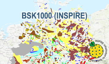
The WMS BSK1000 (INSPIRE) provides basic information on the spatial distribution of energy resources and mineral raw materials (‘stones and earth’, industrial minerals and ores) in Germany on a scale of 1:1,000,000. The BSK1000 is published by the Federal Institute for Geosciences and Natural Resources in cooperation with the State Geological Surveys of Germany. According to the Data Specification on Mineral Resources (D2.8.III.21) the map provides INSPIRE-compliant data. The WMS BSK1000 (INSPIRE) contains five layers: MR.Mine displays important mines. MR.MineralOccurence.Commodity.Point.EnergyResourcesAndMineralRawMaterials displays small-scale energy resources and mineral raw materials as points. MR.MineralOccurence.Commodity.Polygon.DistributionOfSalt displays the distribution of salt. MR.MineralOccurrence.Commodity.Polygon.EnergyResources displays large-scale energy resources as polygons. MR.MineralOccurrence.Commodity.Polygon.MineralRawMaterials displays large-scale mineral raw materials as polygons. The user obtains detailed information on the mineral raw materials, energy resources and mines via the getFeatureInfo request. Notes regarding the portrayal: The colouring of the large- and small-scale energy resources and mineral raw materials as well as of the mines corresponds largely to the colouring of the KOR250 respectively KOR250 (INSPIRE). In addition, the gas and oil polygons are coloured in green and red according to common international practice. The black coal polygons are displayed in their original colour grey. Also the colours of the mine symbols correspond largely to the KOR250 respectively KOR250 (INSPIRE) colouring. Only the salt and potash mine symbols have their original colour. All mine symbols are BGR symbols. The distribution areas of the Triassic and Zechstein salt show the corresponding geochronological INSPIRE colours (see Data Specification on Geology D2.8.II.4_v3.0). The distribution area of salt diapirism is displayed in a BGR colour.
-
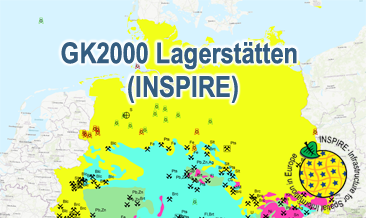
The WMS GK2000 Lagerstätten (INSPIRE) shows deposits and mines of energy resources, metal resources, industrial minerals and salt on a greatly simplified geology within Germany on a scale of 1:2,000,000. According to the Data Specification on Mineral Resources (D2.8.III.21) and Geology (D2.8.II.4_v3.0) the map provides INSPIRE-compliant data. The WMS GK2000 Lagerstätten (INSPIRE) contains the following layers: MR.Mine displays mines. MR.MineralOccurence.Commodity.Polygon.EnergyResources displays energy resources as polygons. GE.GeologicUnits provides the greatly simplified geology of Germany. For different geochronologic minimum and maximum ages, e.g. Precambrian - Cenozoic, the portrayal is defined by the colour of the geochronologic minimum age (olderNamedAge). The user obtains detailed information on the deposits, mines and geology via the getFeatureInfo request. Notes regarding the portrayal: The gas and oil provinces as well as the corresponding mines are coloured in green and red according to common international practice. The black coal fields are displayed in their original colour grey. The colouring of the brown coal fields correspond to the KOR250 respectively KOR250 (INSPIRE) colouring. All mine symbols and commodity abbrevations are BGR symbols and abbrevations.
-
The GK2000 Lagerstätten (INSPIRE) shows deposits and mines of energy resources, metal resources, industrial minerals and salt on a greatly simplified geology within Germany on a scale of 1:2,000,000. According to the Data Specifications on Mineral Resources (D2.8.III.21) and Geology (D2.8.II.4_v3.0) the content of the map is stored in three INSPIRE-compliant GML files: GK2000_Lagerstaetten_Mine.gml contains mines as points. GK2000_ Lagerstaetten _EarthResource_polygon_Energy_resources.gml contains energy resources as polygons. GK2000_ Lagerstaetten _GeologicUnit.gml contains the greatly simplified geology of Germany. The GML files together with a Readme.txt file are provided in ZIP format (GK2000_ Lagerstaetten -INSPIRE.zip). The Readme.text file (German/English) contains detailed information on the GML files content. Data transformation was proceeded by using the INSPIRE Solution Pack for FME according to the INSPIRE requirements.
-
The BSK1000 (INSPIRE) provides the basic information on the spatial distribution of energy resources and mineral raw materials (‘stones and earth’, industrial minerals and ores) in Germany on a scale of 1:1,000,000. The BSK1000 is published by the Federal Institute for Geosciences and Natural Resources in cooperation with the State Geological Surveys of Germany. According to the Data Specification on Mineral Resources (D2.8.III.21) the content of the map is stored in five INSPIRE-compliant GML files: BSK1000_Mine.gml contains important mines as points. BSK1000_EarthResource_point_Energy_resources_and_mineral_raw_materials.gml contains small-scale energy resources and mineral raw materials as points. BSK1000_EarthResource_polygon_Distribution_of_salt.gml contains the distribution of salt as polygons. BSK1000_EarthResource_polygon_Energy_resources.gml contains large-scale energy resources as polygons. BSK1000_EarthResource_polygon_Mineral_raw_materials.gml contains large-scale mineral raw materials as polygons. The GML files together with a Readme.txt file are provided in ZIP format (BSK1000-INSPIRE.zip). The Readme.text file (German/English) contains detailed information on the GML files content. Data transformation was proceeded by using the INSPIRE Solution Pack for FME according to the INSPIRE requirements.